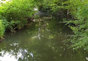
Tocht Stappen La Chapelle-Montligeon - [Itinéraire] Le Gîte Les Bruyères - Photo

[Itinéraire] Le Gîte Les Bruyères

 ODDAD78
ODDAD78

Gebruiker

© OpenStreetMap contributors
Lengte
Lengte
3,1 km
Max. hoogte
Max. hoogte
231 m
Positief hoogteverschil
88 m
Km-Effort
Km-Effort  
4,3 km
Min. hoogte
Min. hoogte
147 m
Negatief hoogteverschil
85 m
Boucle
Boucle
Ja
Datum van aanmaak :
2023-08-26 06:33:57.865
Laatste wijziging :
2023-08-26 06:50:26.558

(0 Bericht)

Stappen
Stappen
57m
Moeilijkheid : Gemakkelijk

Scan deze QR-code om de tocht te openen in de SityTrail-applicatie

Gratisgps-wandelapplicatie

Logo SityTrail SityTrail

IGN / Geografische instituten

SityTrail uit de App Store downloaden SityTrail uit Google Play downloaden

Logo SityTrail SityTrail World

De wereld gaat voor u open

SityTrail uit de App Store downloaden SityTrail uit Google Play downloaden SityTrail op Huawei AppGallery downloaden

Over ons

Tocht Stappen van 3,1 km beschikbaar op Normandië, Orne, La Chapelle-Montligeon. Deze tocht wordt voorgesteld door ODDAD78.

Beschrijving

Départ : La Chapelle-Montligeon Arrivée : La Chapelle-Montligeon Communes : 1. La Chapelle-Montligeon 2. Courgeon
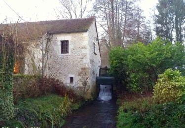
Partir par le bas de la Rue Principale, franchir les deux ponts et tourner à gauche après le deuxième. Le Moulin d’Yon. Le Petit Moulin. A gauche. Franchir la rivière sur une passerelle et, par un petit sentier, gagner Les Maisons Neuves. Continuer jusqu’à L’Hôtel Baudray.
1. Passé le hameau, prendre à droite un chemin creux ombragé rejoignant la D 268. La traverser ; dépasser le gîte de groupe.
2. Peu après l’entrée du terrain de camping, monter à gauche un chemin sablonneux. A un premier carrefour, obliquer à droite.
3. A un second carrefour, en « Y », touner à gauche. Le parcours est humide, obligeant parfois à marcher sur le haut du talus. Arrivé aux Quatre Vents, prendre le sentier de gauche et continuer jusqu’au carrefour suivant.
4. Tourner à gauche et descendre par un sentier en pente raide qui débouche, après un petit décrochement, face à l’entrée de l’Ermitage de la Basilique. Retour place de l’église par la D 268 à droite. (Possibilité d’éviter la pente raide en empruntant le chemin le plus à gauche qui débouche également sur la D 268)
(Pas à pas : Rando-Perche)

Hoogteprofiel

POI's

POI La Chapelle-Montligeon - Flore: La forêt domaniale de Réno-Valdieu - Photo
ODDAD78
LA CHAPELLE-MONTLIGEON 
POI La Chapelle-Montligeon - Histoire: Synthèse communale - Photo
ODDAD78
LA CHAPELLE-MONTLIGEON 
POI La Chapelle-Montligeon - Histoire: La-Chapelle-Montligeon - Photo
ODDAD78
LA CHAPELLE-MONTLIGEON 

Plaatsbepaling

Land:
France
Regio :
Normandië
Departement/Provincie :
Orne
Gemeente :
La Chapelle-Montligeon
Locatie:
Unknown
Vertrek:(UTM)
326608 ; 5372733 (31U) N.

Wandeltochten in de omgeving

Tocht Stappen Longny les Villages - Monceaux au Perche (Boucle) - Photo
Stappen
neitag61

Stappen

Gemakkelijk
(2)
Longny les Villages, Normandië, Orne, France
10,6 km | 13,5 km-effort
2h 30min
Ja
Tocht Te voet Longny les Villages - Attelage - Forêt et Panoramas - forêt de Réno-Valdieu - Photo
Te voet
PRO

Te voet

Gemakkelijk
Longny les Villages, Normandië, Orne, France
7,6 km | 9,3 km-effort
2h 7min
Neen
Tocht Stappen La Chapelle-Montligeon - [Itinéraire] Le Mont Ligeon - Photo
Stappen
ODDAD78

Stappen

Medium
La Chapelle-Montligeon, Normandië, Orne, France
5,1 km | 6,6 km-effort
1h 30min
Ja
Tocht Stappen Cour-Maugis sur Huisne - 12102996-Maison Maugis 22.37 - Photo
Stappen
togolo28

Stappen

Medium
(1)
Cour-Maugis sur Huisne, Normandië, Orne, France
22 km | 28 km-effort
Onbekend
Ja
Tocht Stappen La Chapelle-Montligeon - La Chapelle-Montligeon - Longny-au-Perche via Bizou 16 km - Photo
Stappen

Stappen

Zeer moeilijk
La Chapelle-Montligeon, Normandië, Orne, France
15,9 km | 20 km-effort
4h 22min
Neen
Tocht Stappen La Chapelle-Montligeon - La Chapelle-Montligeon - Moutiers-au-Perche via Bizou 20 km - Photo
Stappen

Stappen

Zeer moeilijk
La Chapelle-Montligeon, Normandië, Orne, France
20 km | 26 km-effort
5h 33min
Neen
Tocht Stappen La Chapelle-Montligeon - La Chapelle-Montligeon - Le Mage via Bizou 18 km - Photo
Stappen

Stappen

Zeer moeilijk
La Chapelle-Montligeon, Normandië, Orne, France
17,9 km | 23 km-effort
4h 53min
Neen
Tocht Stappen Longny les Villages - Monceaux et le Manoir - Photo
Stappen
MichelRando7656

Stappen

Gemakkelijk
Longny les Villages, Normandië, Orne, France
7,6 km | 9,6 km-effort
3h 0min
Ja
Tocht Stappen Longny les Villages - Minceaux 2 - Photo
Stappen
olaf60

Stappen

Heel gemakkelijk
Longny les Villages, Normandië, Orne, France
10,6 km | 13,5 km-effort
2h 7min
Ja


Sluiten
Mijn abonnementen